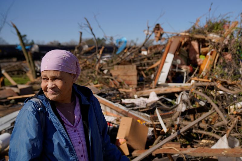
The weather pattern has been relentless in recent weeks. There have been more than 160 tornado reports since Friday, March 24, when 26 people were killed in severe storms and the town of Rolling Fork, Mississippi was hit the hardest.
In the past week alone, more than 30 people have been killed by storms. Combined, fatalities over the last two weeks account for more than half the number of tornado deaths we typically see in an entire year. It’s too many. Even one death is too many.
Communities in the South and mid-South have had nights filled with tornado warnings and sirens. Early mornings are filled with wondering about what’s left of their town. Families are forced to regroup and reset quickly before the next round of strong storms threatens.
And this week will be no different.
Researchers meet storms face-to-face
Tornadoes always feel random. Some towns are spared, and some are hit hard. Within those hard-hit towns, some homes are destroyed, and some are untouched. It is just one of the mysteries of these forces of nature.
The PERiLS project (Propagation, Evolution and Rotation in Linear Storms) is hoping to take some of the guesswork out of which storms will produce tornadoes and which ones will not. The two-year project is currently in its second season, which has been full of opportunities to research storms.
Chris Weiss, a meteorologist and professor at Texas Tech, has been helping to lead the charge on the PERiLS project, not only to improve lead times on storms, but to minimize false alarms when it comes to tornado warnings.
“You want to try to reduce those false alarms as much as possible because when you get repeatedly warned, and an event doesn’t occur, you tend to heed that warning less,” Weiss explained.
He and his crew have traveled more than 3,000 miles this season, placing instruments called “sticknets” out in front of the storms to take measurements and learn why certain storms produce tornadoes and others don’t.
Sticknets are portable weather stations used to sample the atmosphere. They measure temperature, relative humidity, wind speed and direction as well as air pressure. If placed perfectly, they will sample the changing atmosphere as the storm rolls over it.
“I was just thinking back to the Rolling Fork event from a couple of weeks ago. And one thing that struck me in real time there was how quickly the environment changes ahead of these storms,” Weiss explained. “As the storms got closer, you had this rapid destabilization, and the storm just really takes advantage of that. And that’s tricky for a forecaster that has to anticipate that.”
Weiss hopes with the work he and his team are doing, tornadoes will become easier to forecast, resulting in much more lead time for affected communities.
Weiss and his team have been out in some of the strongest storms this season and will be out again this week when severe weather threatens.
This week’s weather
Another strong storm system will take aim at the midsection of the country this week, threatening millions.
“Many of the areas that got hammered by the last severe weather outlook could be at risk again, so it’s imperative that everyone in this region closely monitor the latest local forecasts and be prepared to take cover if warnings are issued,” the Weather Prediction Center warned.
There’s a Level 2 “slight” chance of storms today, for portions of the Florida Panhandle and southern Alabama. Popular beach destinations like Pensacola and Panama City need to be on the lookout for storms.
The bigger threat of storms this week will arrive on Tuesday.
The Storm Prediction Center has placed a Level 4 of 5 “moderate” risk of severe weather for portions of the Midwest, including northeastern Missouri, southeastern Iowa and western Illinois. Cities like Davenport, Cedar Rapids and Iowa City will be under the greatest risk.
A tornado watch vs tornado warning
“Moderate risk for severe weather again for our area on Tuesday as a volatile setup looks to be taking shape,” the National Weather Service office in the Quad Cities said. “The environment is primed for significant severe storms.”
The region had dozens of tornado reports Friday, and it could see more activity less than a week later. The weather service urged people to stay alert.
“We must remain vigilant and stay tuned to the forecast again,” the weather service urged.
There are also two areas labeled as a Level 3 of 5 “enhanced” risk of severe weather stretching from East Texas to southern Wisconsin. Cities like Des Moines, Springfield and Little Rock could once again be at risk of severe weather, including strong tornadoes.
Little Rock alone had at least 50 people hospitalized after a tornado swept through on Friday. Preliminary reports estimate the tornado was an EF-3 with winds up to 165 mph. It carved a path 20 to 25 miles long.
While severe weather and the talk of strong tornadoes will dominate the headlines across the southern side of this storm system, blizzard conditions will dominate the northern side as it affects the Rockies, the Plains and Midwest.
“A highly anomalous April snowstorm with blizzard conditions is expected from northwestern Nebraska and across the central Dakotas and then into northern Minnesota,” said the prediction center.
Blizzard warnings are in effect from northern Nebraska to central North Dakota through Wednesday.
The National Weather Service office in Rapid City is forecasting up to 20 inches of snow, along with 60 mph winds, making travel impossible for many.
The last few weeks have consisted of a steady string of violent storms, dozens of deaths and entire towns left in ruins.
