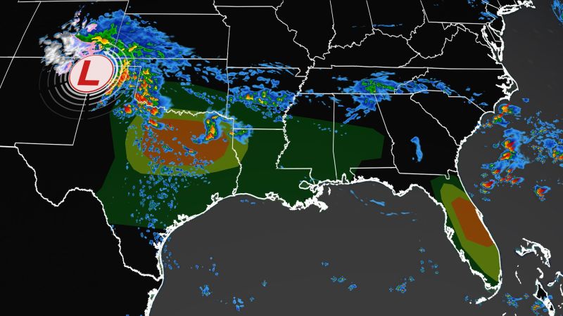
A dynamic storm system is setting up Wednesday across the South, with the possibility of severe storms and huge hail, especially in Texas and Florida.
Across central Texas, the threat of “very large to potentially giant hail” is a main concern, along with the risk of damaging winds, flash flooding and isolated tornadoes, especially in the evening, the Storm Prediction Center said.
“The tornado threat should increase significantly during this period, with the potential for a strong tornado or two,” it said.
Much of central Texas, including the Dallas Metroplex, is covered by a Level 3 of 5 “enhanced risk” for severe weather as the strongest rounds of storms are expected to fire up over Texas and Louisiana, south of a stationary front as a cold front approaches.
More than 2 million people are under a tornado watch in central Texas – including southern parts of the Dallas-Fort Worth Metroplex – until 11 p.m. ET Wednesday. Powerful wind gusts up to 75 mph and hail the size of softballs could batter the region, the prediction center warned.
“Some of the tornadoes could be strong, and damaging winds will likely become a greater concern this evening as thunderstorms grow upscale into a bowing cluster,” the center said.
